Your Network on a Map
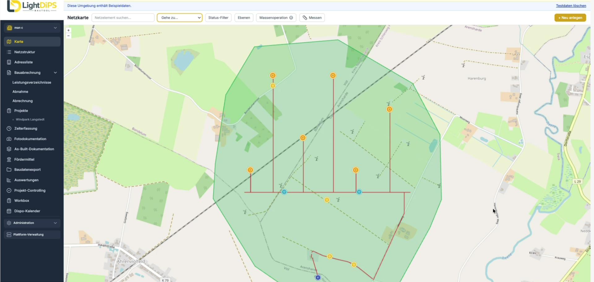
All network elements are displayed on an interactive map with georeferenced data and can be filtered by type, status, and condition. Points, lines, and areas can be displayed on official BKG maps or satellite imagery. This allows you to see at a glance how far along your project is and where action is needed.
Manage and Complete Projects in a Structured Manner
Work orders are assigned directly to the respective network element and forwarded to the responsible employees. Required fields, photos, and measurement reports ensure that all necessary information is recorded. If important documentation is missing, the work order cannot be completed. This reduces the need for follow-up inquiries and ensures complete documentation from the start.
Plan Staff and Assignments Strategically
Jobs can be scheduled based on qualifications, availability, and route. Integrated route optimization supports scheduling, while work hours can be digitally recorded and approved via defined workflows. This enables centralized management of the network, jobs, and resources.
Digitally Record Measurements and Construction Invoices
Bills of quantities can be imported via GAEB, and measurements can be recorded directly for each order. Quantities derived from existing geometries are already available. For billing, a verifiable GAEB export can then be generated. This creates a seamless digital process from measurement to billing.
Preparing Funding Applications in a Structured Manner
LightDiPS supports the creation of the required formats for funded projects, including GIS NB funding exports and XTrasse plans. The grant management module provides a transparent and audit-proof representation of the funding process and enables the separate management of federal and state grants. This ensures that relevant documents and supporting evidence are centrally available.
AI Assists with Documentation and Auditing
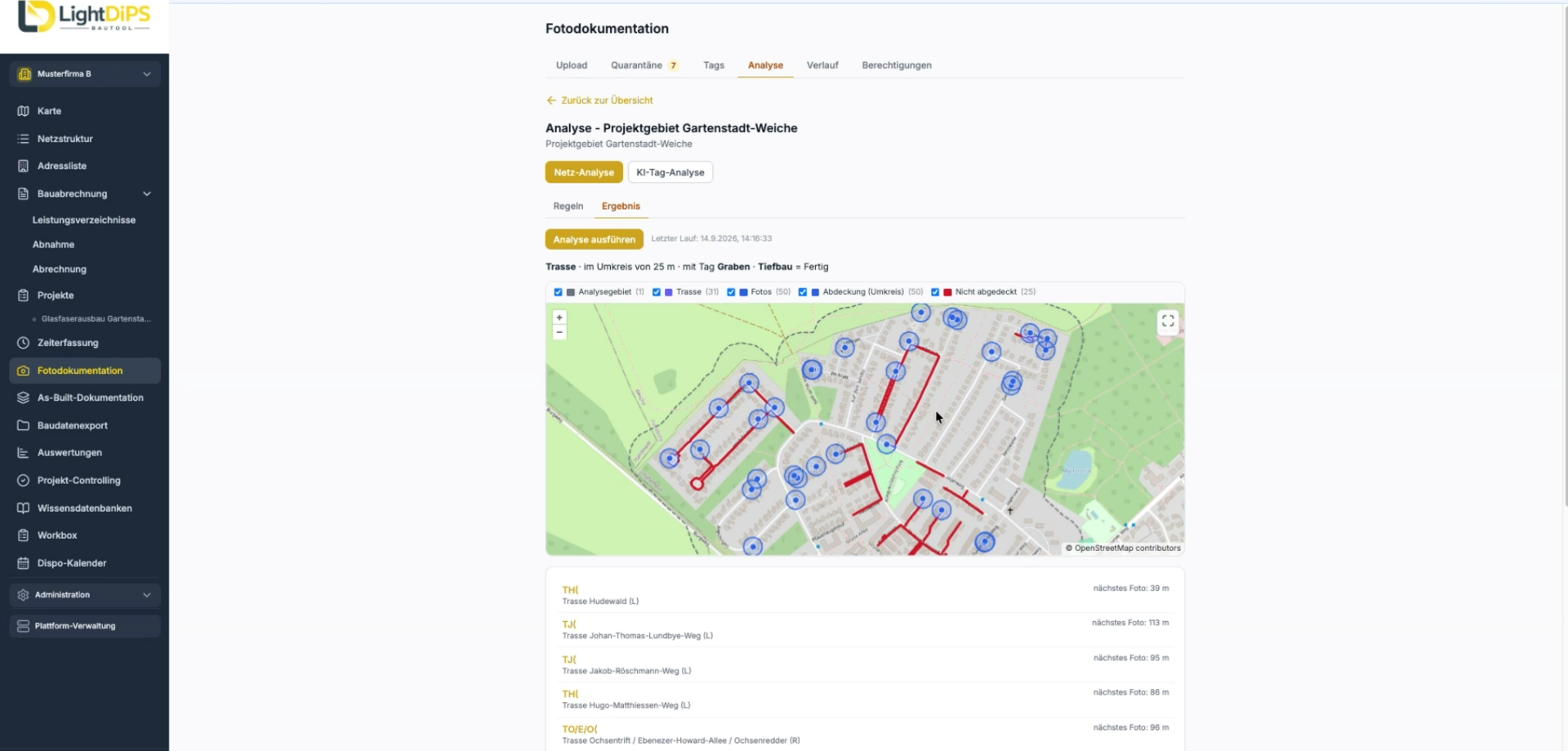
A built-in AI assistant allows you to run queries based on your project data and provides the corresponding sources. The photo analysis feature helps you review construction site photos for required documentation. OTDR measurement reports can also be automatically checked for plausibility. All data remains within the EU.



How much does LightDiPS cost?
LightDiPS costs €49 (net) per user license per month. New clients can try the platform for free for 30 days. User licenses can be managed, added, or canceled directly within the application.
Who is LightDiPS suitable for?
LightDiPS is designed for network operators, energy providers, and other stakeholders in infrastructure projects, including project managers, clients, subcontractors, and technical staff. Preconfigured application packages are available for fiber-optic expansion, solar farms, wind energy, sales, and maintenance, among other areas.
What sets LightDiPS apart from a traditional construction site app?
LightDiPS goes beyond simply capturing photos and tasks. The platform integrates network management, job control, quantity surveying, construction billing, grant reporting, and AI-powered inspections. At the same time, it addresses specific requirements of network expansion, such as OTDR measurements and requirements from grant-funded projects.
Can LightDiPS be connected to DiPS fiber optics?
Yes. Through integration with DiPS Fiber Optics, building data can be imported and status information for network elements can be synchronized. This allows existing data to be reused and reduces duplicate data maintenance.
Where is my data processed?
The data is processed within the EU on a client-by-client basis and in compliance with the GDPR. This also applies to processing carried out as part of the integrated AI features. The AI features can also be completely disabled if necessary.